Category: Drives
-
Drive to Quetico Provincial Park
September 5, 2025 at 5:46 AM 41 deg at 6:00 Martha had learned about a special sweet roll while she was waiting on a bench at the shower house back in Rabbit Blanket campground, Lake Superior Provincial Park. “If you go to Thunder Bay you must try a Persian!” said the young lady who was also…
-
Move to Sleeping Giant Provincial Park
August 29, 2025 39 degrees at 5:00 am We both have the cold now, and it’s one of those that stay with your for a while. After six days here, we are about out of fresh water, although you can refill in front of the shower house. The 3.5 hour drive from Pukaskwa and Nipigon…
-
Lake Superior Provincial Park
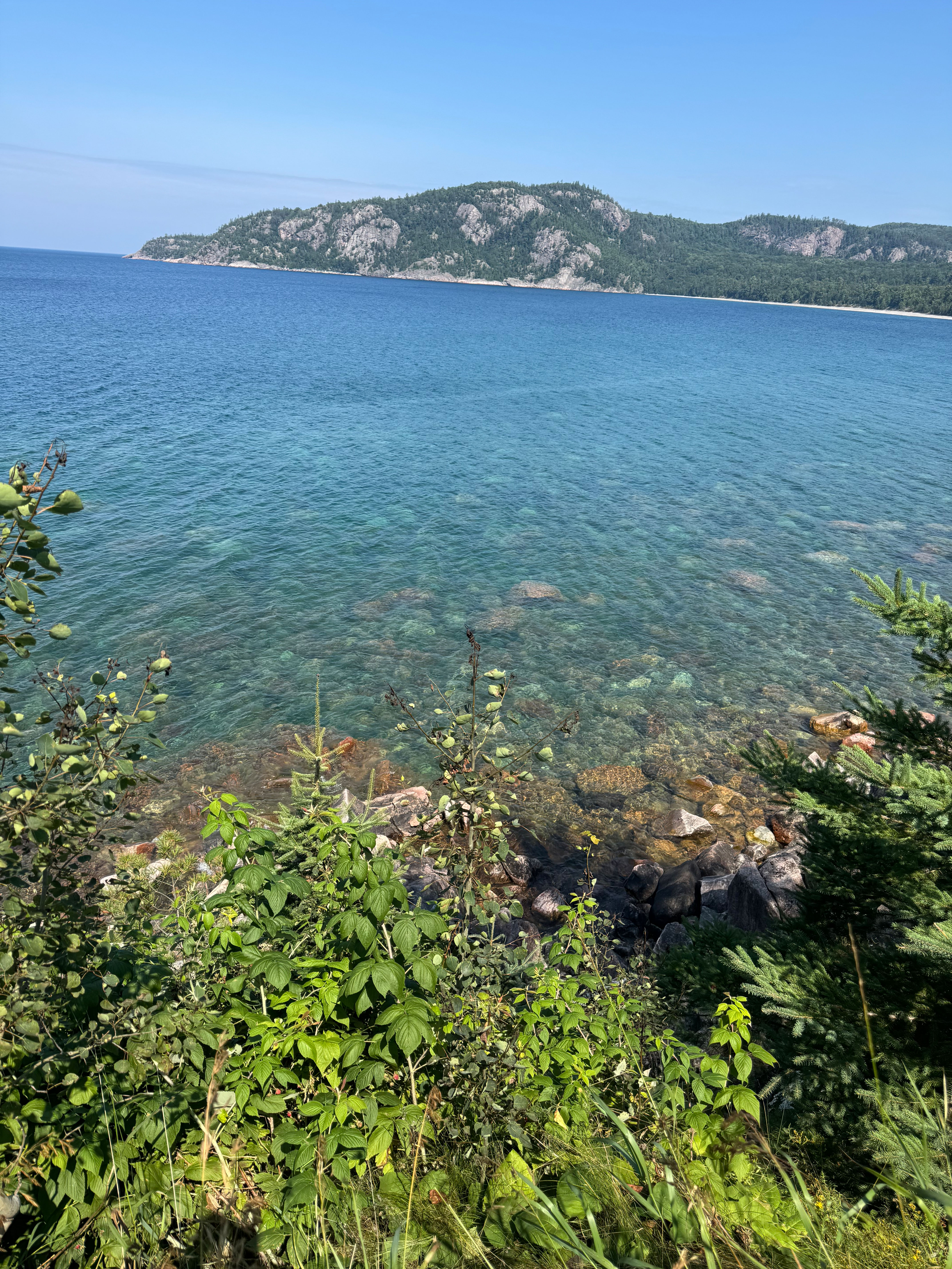
Checkout wasn’t until 2:00, so we took an “easy” hike from the campground through a forest, then across a fen. Martha explained to me the difference between a bog and a fen. Water doesn’t move in a bog, but does in a fen. I wore my bug shirt this time, and the mosquitoes were sure…
-
Garden of The Gods & Pike’s Peak
Tuesday, September 6, 2022 It is about a 5.5 hour drive from Durango to Colorado Springs, which is northeast of Durango. It takes us about an hour or so longer by the time we stop for lunch, gas and whatever else happens. Pulling the Airstream makes us a little slower, but not that much. We…
-
The Million Dollar Highway
Friday, September 2, 2022 42 degrees at 6:00, high of 90. First we went to a Durango fruit and vegetable stand and bought a few things. All the locals seemed to be stopping by. Roaster green chilis are in season. The Million Dollar Highway is the section of the San Juan Skyway from Silverton to…
-
The Enchanted Circle Scenic Byway
August 29, 2022 42 deg at 6:00, high 79 Listed as one of the top things to do in Taos is to drive The Enchanted Circle. It is a 2.5 hour drive if you don’t stop, or an all-day trip if you take your time and enjoy the sites, which is what we did. Heading…
-
Sedona, AZ to Santa Fe, NM
Friday, August 19, 2022 It’s a convoluted drive out of Sedona. You have to drive south, then east to I17, then north to I40 east. On Monday I had taken my truck to Flagstaff for an oil change. I drove north on 89A, which is a beautiful road, but it is a winding, narrow mountain…
-
The Narrows, Zion National Park
July 11/12, 2022 Featured picture by Karen Human We drove north from Cannonville, through Tropic and Bryce on Rt. 12 and turned south on 89. I read an article called “Everything’s Fine on 89”, which I can’t find now. From https://usroute89.com: “Tour seven National parks, fourteen National Monuments and three Heritage Areas all on one…
-
Great Sand Dunes to Moab
June 27, 2022 It rained all night, which I would think is unusual for this area. Yesterday we were able to book another night in Capitol Reef National Park. We had one night in site 28. Now we have a second night in site 29. They have had some terrible flooding. Hopefully it will be…
-
Dodge City to Great Sand Dunes National Park
Friday, June 24, 2022 There are three routes to Great Sand Dunes National Park. We took 56 southwest to 160 because I had never traveled it. This was the last big travel day getting to the southwest for our extended tour. As we drove through working communities of Ensign, Montezuma, Hickok and Ulysses, we drove…