The Hickman Bridge hike is a 2-mile out-and-back trail to a 133 foot natural bridge with views of the canyon. We had a beautiful day to hike after setting up camp in the Fruita Campground beside the Freemont River. Deer frequent the grassy campground. The hike is a good one, with good scenery.
Revisiting Canyonlands was fun. Sitting up on a high mesa, it is 10-15 degrees cooler than Moab. We walked the Rim Trail, and Karen was able to take a 3-mile run. It is a pleasant park divided into three parts by the Colorado and Green Rivers. Some parts are only accessible by gravel o9r sand roads from the south. floating through it on one of these rivers would be a great way to see it.
Karen, Josh and Melissa flew into Grand Junction, Colorado, about an hour and a half from Moab. Their flights were on time and without a hitch. We stopped for lunch at Qdoba, which was very good.
First driving west on I70, we turned SW on 129, which follows the great Colorado River through a beautiful canyon. We stopped several times for pictures and stopped at Sandy Beach and stood in the water. Melissa did one better. She went all the way in, then laid on the hot sand making sand angels.
There is a very pretty Lion’s Park and bike trail that extends 3 miles upriver from Moab. It also goes up to the entrance of Arches National Park and into and through the town of Moab. It is a great place for walkers, runners and bike riders.
Saturday, July 2, 2022
We got up at 4:10, and left at 4:30 in order to see sunrise at Delicate Arch. We had headlights, thinking we would be walking in the dark, but there was a pre-dawn light, so we really didn’t need the lights. Why so early? Martha and I had taken this hike a few days ago, and I will never forget passing a pretty girl carrying a camera. I asked if it was still there, and she said, “Yes, but the sunrise isn’t.” We were determined to catch the sunrise this time. This is an easy hike for Karen and the kids, but not so much for us, but we made it for sunrise 😊.
It is only a mile and a half hike, for a three-mile round trip, but it is an up-hill climb that is quite strenuous. It is a beautiful hike, finishing along a ledge with steep drop-off. Since we had done this before, I brought the 70-200mm lens. While Karen and the kids climbed to a high spot to see the sunrise, I was taking pictures of the arch when a voice with a heavy accent asked, “Can I see what you are taking?” I turned to show my last picture. He was interested in the lens and settings, and was a handsome young man from Ukraine. There were six or seven of them in a group. I asked him how things were in his country. He said, “The 21st century is crazy.” A perfect description I thought. I’m not sure what the story was, but they were having a big time.
As we sat watching the sun rise, making all kinds of light changes on the arch and surrounding cliffs, more and more people came up the mountain. They came speaking all kinds of different languages. Everyone wanted pictures under the arch. I was surprised how courteous they were, waiting their turn, then being pretty efficient in getting their pictures and getting out of the way.
The hike back down is easier, and we could look at the beautiful surrounding mountains. Again, we took the side trail to some of the best petroglyphs I have seen. Although a bit difficult, we would rate this hike at the top of our list. The arch is beautiful; the surrounding mountains are spectacular; the hike up a huge rock hill is cool, then walking along a cliff edge is cool, but an important part was unexpected. The people from all over the world, speaking different languages, small children, all with courtesy and respect. They took their shots under the arch, then got out of the way for the next group. Across the valley, Martha spotted another group viewing the arch from behind, perhaps with the sunrise showing through the arch. Cool!
To avoid the heat, we drove 40 minutes to Canyonlands National Park, up a big mountain and onto a giant Mesa that is divided into three sections by two rivers, the Colorado and the Green River. Like the Grand Canyons, the mesa sits above the rivers, carved away by a giant inland sea, the Cretaceous Seaway or the Western Interior Seaway.
“The Cretaceous Sea, also known as the Cretaceous Interior Seaway, was a narrow, rather shallow sea that connected the modern Gulf of Mexico and modern Arctic Ocean. The formation of the sea is rather complicated. Basically, the Earth’s crust is divided into slabs of crust called plates. These plates float on semi-molten rock and get pushed around by rising hotter rock and get pulled towards areas of sinking cooler rock. Sometimes the plates collide and this can result in crumpling of the crust forming mountain ranges. As mountains are pushed upwards, they often pull the surrounding land down making the landscape look like a crumbled rug.” From https://eastern.usu.edu/museum/paleontology/cretaceous-sea/index
Continuing from Utah State University Eastern:
“Simplified, the story began about 170 million years ago, during the Middle Jurassic as the North American Plate moving west at about an inch per year, started a slow crashed into the Farallon Plate that was moving east at about the same speed. Over the next 105 million years this slow-motion collision created a series of mountains between the west coast and western Utah. To the east of these mountains, the land was pulled downwards allowing ocean water to flood the center of North America.
This down-pull was erratic and the land surface would alternately bob up-and down very, very slowly over millions of years. The result was alternating times of submergence below sea level and rising above it. During the Cretaceous, the central part of North America began a downwards cycle around 130 million years ago (Early Cretaceous) and the sea reached Utah around 110 million years ago. The landscape began bouncing upwards around 70 million years ago, forming the Rocky Mountains and pushing the ocean off the continent. Much of this up and down motion during the Cretaceous is preserved in the Book Cliffs and in the Grand Staircase National Monument as alternating layers of marine and terrestrial sedimentary rocks as the coastline shifted back and forth. It is for this reason that these areas are famous among geologists.”
We were up early, so we grabbed some things and drove north 10 minutes to Arches National Park. The park is so busy, you have to reserve an entrance time between 6:00 am. and 5:00 pm. We got there at 5:30, showed our National Parks Senior Pass and drove right in. There were others in front and behind.
It’s about 12 miles to Delicate Arch trailhead, the featured attraction of the park. It’s hard to zip along, because the scenery is so spectacular. It was a beautiful morning with some cloud cover, a perfect morning for a hike.
The hike is 3 miles round trip, rated moderate. It’s a cool hike with incredible scenery. A pretty girl with a nice camera was walking out. I asked her if it was still there, and she said, “It is, but the sunrise isn’t.” I smiled and walked on. I guess we were about an hour late. The last stretch is along a cliff, which I do NOT like, but we made it. I could see why this is #1, as it is unique and very pretty.
On the way back out, we took a short side trail to some pretty spectacular petroglyphs made by the Ute Indians, for whom the state of Utah is named.
We stopped for a picture of Sand Dune Arch. Then we drove through the campground. It’s a very cool campground. Two sites had spectacular views of the valley below. One in particular looked so cool. A young lady was making breakfast with that view in front of her. There are also some nice picnic areas near the campground.
Then we went for a 1-mile hike to Landscape Arch. By now the parking lots were filled and the trail busy, but not really a problem. People watching is also fun. There were lots of young children, some not looking so happy. One very fit mother was carrying an infant on her back and holding the hand of a young girl.
There are 2,000 arches in the park! The landscape changes dramatically with different shapes, vertical walls that seem to have been cut with a laser. I envisioned riding a horse through a gorgeous valley below.
By 9:30, I was tired and sore and now hot. This is a good time to be finished, although the crowds were still pouring in. At the entrance cars were lined up for a quarter mile in two lanes.
Back at the trailer it was well into the 90’s, a good time to finish my projects. I finally I realized I had to go back under the sink and rotate the base 180 degrees and turn the handle around. Voila! It all worked! We have water 😊. As a bonus, the sprayer worked – not great, but it worked. There is a little spring with a plastic basket that goes in the line under the sink, but I couldn’t figure out how to place it, so I left it out.
On to the reading light. Trying to solder a dangling light proved a challenge. With Martha’s help, we tried a few times, but managed to just end up with a big ball of solder that didn’t hold. Finally, I saw how to remove the little on/off switch, which made access better. I cleaned off the solder, and while I held the the wire to the switch pole, Martha held the solder in her left hand, soldering iron in the right, and working between my two hands holding the wires, she soldered it! How she managed to not burn our fingers or touch the other pole, which would have blown a fuse or worse, is amazing, but she did it!
We screwed the light back in its hole, turned it on and it worked! Yahoo! It was a good day. I put all my tools back in the truck and cleaned up. It was 105 degrees outside, and pretty hot inside. The air conditioner runs all day, and never catches up during the day. We both considered that. God help us if that thing dies! We turned it off for a while and sat outside. Oddly, sitting in the shade with a little breeze is fine. A dip in the pool also helps, but by the time we walked back to the trailer in the sun, we were hot again.
We took Bob to dinner at his favorite pasta place and enjoyed further conversations. He had ridden his bike all through town this morning and found the trail with a line down the middle goes all the way through town, a street behind Main Street. This will give Karen even more distance to run when she comes. He said all side roads just lead to developments, although several were very nice.
We drove up the side of a mountain to Sunset Grill to see what the view was like. It was pretty spectacular. We could see the whole town, and for the first time to realize the town sits in a valley. It is also bigger than how it seems when you drive through it. Bob heads out tomorrow for Montrose, Colorado. Maybe we can visit later down the road.
50 degrees at dawn with a high of 61, probable rain.
The Mosca Pass Trail is an out-and-back hike of 6.4 miles with moderate difficulty, rated 4.5. Since the elevation is already over 8,000’ and the hike gains 1,459’, we took it very slow with frequent stops to catch our breath. A sign at the bottom warned of mountain lion sightings. It is a perfect place for them with lots of cliffs and rock ledges on which to perch. I know attacks are rare, but I kept looking behind, and I carried a can of bear spray.
Mountain lion is my guess.
As described on “All Trails”, there were lots of birds and flowers. We stopped at two miles and turned around. It’s our first real hike, and we didn’t want to wear ourselves out. With misting rain and temperatures at 56 degrees, it was a perfect day for a hike. By the time we got to the bottom, the parking lot was getting full.
After lunch, we cleaned the trailer and worked on the water lines. We disconnected the faucet lines, put a pot under the cold water line and turned it on. Happily, water flowed strongly. We did the same to the hot water line, and it too flowed strongly. Since I have shoved a wire into the hoses and the faucet, but can’t get it through, I think the on/off valve is stuck. I’ll get a new faucet in Moab tomorrow.
I didn’t know what to expect when I booked Great Sand Dunes other than there were massive sand dunes with a stream running along the edge. But we are here to see national parks and monuments and this is the first one on our way west.
I booked three nights at Great Sand Dunes Oasis RV Park. I knew we would need a break from four days of driving. In another location, it might be described as a gravel parking lot, but it sits on a plateau overlooking the massive San Luis Valley, a high elevation desert at 7,694’. They have it all – RV campground, cabins, lodge, gas station, store and a restaurant.
It is certainly a strange thing to find massive sand dunes in the Rocky Mountains. There is a massive wall of mountains that are in a curve. Winds are quite intense here. The prevailing westerly winds blow across the valley floor, pushing sand up against this mountain catcher’s mitt. They shift, flow and yet the measurements of the peaks haven’t changed much in 140 years.
Also unique is having three streams run past the dunes. As the stream hits the sand, it seeps into the sand and goes underground just past the dunes.
Martha fixed a great breakfast of sauteed peppers, onions and tomatoes with a splash of vinegar, coriander and cumin. She made wells and cracked eggs into them. Yum!
We went to the Visitor’s Center, a pretty adobe building. It is a nice store with some interesting books. The views form most Visitor’s Centers are great, and this was no exception. It is perfectly located.
Totally unprepared for the day, we walked across the stream, which consists of ribbons of water an inch or two deep, Martha in her Keens and me in my hiking shoes. With wind blowing from the East (a storm wind), we plodded up the dunes to a level I felt was sufficient and watched others sliding down the dunes on boards designed for the purpose. Others climbed to the very top – 750’. With elevations at 8ooo’, we felt the effects, heart racing, breathing impaired and slightly dizzy.
We drove through the park campgrounds, which were nice, but I like our spot better. It’s a weekend, so every site was taken. There is a dirt road going through Medano Pass. I talked to a man at the Visitor’s Center, who was putting air back into his Jeep tires after coming across the pass this morning. I asked if my truck would make it, and said, “about half way.” My GMC is not an off-road vehicle, although it has four wheel drive. I only drove up it a short distance before realizing this would not be a good idea.
We did drive to a small parking lot where there is a 2.5 up-and-back hike to a view point. Again, the altitude affected us. The views at the top were rather spectacular.
After lunch clouds and rains came, so we enjoyed a quiet afternoon. Martha mad an innovative dinner using the last of the rotisserie chicken. She essentially made a chicken pot pie with out the pie crust, but put it over a nice crusty bread. It was excellent.
In the night, the winds blew like crazy. I had my window open, and the sounds kept waking me up. I had my blanket on and was still cold, but after closing the window, it got stuffy, so I opened it again. By morning, the winds had stopped. I now understand how these sand dunes get built up and rearranged!
There are three routes to Great Sand Dunes National Park. We took 56 southwest to 160 because I had never traveled it. This was the last big travel day getting to the southwest for our extended tour.
As we drove through working communities of Ensign, Montezuma, Hickok and Ulysses, we drove through serious farm land, land that had to be watered to make it work. Huge windmills covered the area for miles. As we drove on, there was also oil production. A train line went between the towns, loading grain from gigantic silos. The road was also busy with tractor trailers. The communities were more like corporate work areas.
The further west we went, the drier it got. We saw abandoned homesteads, small, stone structures. If Rt. 50 through Arizona and Nevada is appropriately named The Loneliest Road, Rt. 160 to Trinidad might come in second. As the land became drier, even if land was given to people, they couldn’t make it work.
We stopped in the rather abandoned town for a bathroom break. Fortunately, I checked the refrigerator temperature. It was 44 degrees. The gas was not lit, so I turned the refrigerator off, switched propane tanks and turned it back on with no effect. I turned on the gas stove, but the flame was very weak. I know the tanks have propane, but now all kinds of thoughts ran through my head. Did the mice chew up my gas line?
In the small town of Kim, we spotted a big propane tank. Stopping to ask if they did refills, a gentleman said no, but the man across the street sometimes does. Looking across the road, I saw a small, house-type propane tank. I went across and knocked on the door. A gentleman with hearing aids came to the door. “No”, he said, “We used to run the propane business across the street for 30 years, but the new owners don’t do refills.” I told him I thought we had propane, but the flame is weak. He said, “Drive the rig over here. You can turn around in the yard, and I’ll fill it for you.”
Bud was his name, and he is the epitome of a midwest or western gentleman. He also has a camper and appreciates the travel and issues you can have. As he filled the not-so-empty tank, we talked about Kim. There was a pretty stone building across the street that was built by the WPA and is now used by Colorado Highway people.
We thanked Bud profusely, and offered $30 for propane and peace of mind. He took the $10 and refused the $20.
I loved driving 160 and all it’s changing scenery. I almost hit a big, strong antelope that jumped in front of us, but then jumped back to the side of the road. The speed limit is 65 and I was going 70, so it wouldn’t have been good. I just got a glimpse of him, but I have a vivid picture of him. Best to have a full tank of gas, water and snacks when driving this road. However, if you get in trouble, there are good people to help.
We stopped for lunch in Trinidad, then turned north on I-25 for 35 minutes to Walsenburg and turned west on 160 again. Pulling into Great Sand Dunes Oasis RV Park, I was a little nervous. When I called to make a reservation, a young man seemed a bit detached. There was no credit card transaction, and they don’t send confirmation emails. We did have a confirmation number. Thankfully, all was well and we proceeded to our campsite.
It was 3:00, so I had two or three hours to work on our plumbing issue. I am now pretty familiar with taking it all apart, so I removed the faucet with the attached water lines and tried to blow them out with our air compressor. No dice. I tried flushing with water with no luck. I then pushed a wire up the hose, but it wouldn’t go through the faucet. Maybe I’ll just buy a new faucet in Moab, but we still don’t know if the problem is in the faucet or further down the line. Maybe I’ll connect a hose to the cold water line, run it out the door and turn on the water pump. If that runs strong, I’ll put it on the hot water line. If that runs strong, I’ll go buy a new faucet or get someone to take the lines off of this one.
We sat watching the views and the sun go down from our plateau campground overlooking the valley and Great Sand Dunes. It’s so unique to see huge sand dunes up against the Sangre de Cristo Mountains, the southern section of the Rockies.
53° at 6:00, batteries at 45%, fresh water tank 0%
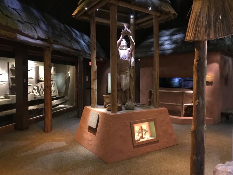
I went to the Museum of The Cherokee Indian. The town of Cherokee is in the middle of the Cherokee Indian Reservation, 57,000 acres of land, known as the Qualla Boundary. Their land covered large parts of North Carolina, Tennessee, Georgia and Kentucky and measured in square miles before President Jackson threw them out, marched them on the “Trail of Tears” and took their land.
It is a large and excellent museum. It walks you through history starting at the Archaic Period 9,000 – 900 BC, showing relics from that period. In the Mississippian Period a new kind of corn was introduced, which changed things for the better. I was very interested in how they fired pottery when there were no ovens.
The history of basket-making was detailed with some huge baskets, at least one surviving from its original time. Also interesting were the tools they were able to make with wood, leather and stones. Hammers, picks, axes and of course, arrows and spears.
Their games were described, some with serious competition. Stickball was huge as well as Chunkey. Hunting and fishing would have been incredible in this area. There are so many streams and rivers.
And then the Europeans arrived. One sign describes it perfectly. At first they prospered with new tools, new ways to farm and guns. King George forbid whites settling i”n the Appalachians and all parts West. We thought we would be safe…..but then came the American Revolution.
Sequoyah, who wrote Cherokee language
Unimaginable today, a book I am reading compares “The Trail of Tears” to the “Bataan Death March”, along with the lies and dirty deals Andrew Jackson made. Some refused to go. Some hid in the mountains, so there became a “Western Band” and an “Eastern Band” of the Cherokee Nation. Thousands died along the trail, many by diseases spread by the Europeans. $3 million was given for their land, but the seller did not want to sell. It was called The Indian Removal Act, and involved not only the Cherokee, but the Chickasaw, the Creek, the Seminoles and the Choctaw, virtually all of the Native Americans in the southeast.
Charlie Roberts, the fly tier I met at Chasteen Creek, told me to try Kephart Prong and to start fishing where the stream makes a big turn away from the trail. My plan was to fish this all day. I’ve been distracted by other things, and the fishing has taken a back seat. I have fished every day, but today, that was all I was going to do. Two cars were parked in front of me when I arrived at 8:00. Now maybe that sounds late, but the sun doesn’t come up until 7:20, and it was only 50°. My guess is they were hikers. There are lots of hikers in this park, and why not? There are tons of trails that are well-marked and maintained. There are backcountry campsites all over the park. If you are a hiker, this is paradise. Of course the Appalachian Trail goes right through the center of the park along its highest ridges.
I didn’t bring the Garmin GPS, telling myself, “Why would I need it?”. I did bring the InReach, which is a satellite device that allows me to send messages and track where I go. Martha had sent a message on it asking where I was. It also has a map I can access with an app on my phone. Trouble was it wasn’t giving me any detail. Seems I need to download a map. OK, I was going to walk up the trail until I could see the stream turning away from the trail (a road really).
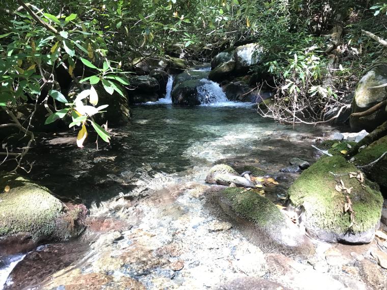
After crossing the beautiful stream a couple of times, I thought it turned away from the trail, so I started fishing. I came here for 9 days of fishing because I had seen so many beautiful streams on my previous trip, and this was another one. It’s the perfect size. With huge boulders, plunging pools and crystal clear water, I could see why Charlie recommended it.
I had on the purple fly with white hackle that had at least produced some interest. I don’t know what it is – maybe a purple haze. I got some small fish splashing at it, but after 40 minutes of that, I decided to switch. There was a serious hatch of tiny brown bugs, yet I didn’t see any fish rising. I was not going to fish anything that small, but I put on a # 16 brown Caddis. 20 minutes later with zero interest, I went to a Royal Wulff. Nothing. Climbing this mountain through one beautiful pool after another, there HAD to be fish in here!
It was not easy going, climbing over and around boulders, going up a steep mountain. I had to get out once to get around a waterfall, but that wasn’t so easy either. Wandering around the forest, climbing over logs and fallen trees, I watched every footstep for a moving stick. I don’t hear so well, and with a pounding stream beside me, I would never hear a rattlesnake trying to warn me. At least I didn’t want to step on one. I was relieved to get back in the stream.
There was a big hatch of these, whatever they are!
I have never seen so many hatches – constantly, all day long, and different kinds. I switched to a Light Cahill. First cast a hit! A voice said, “And now the fun begins.” Like the Purple Haze, little fish hit it, but not much else. One nice fish took it as the fly went under a rock. I thought I was caught on something, but it moved, wiggled and then it was gone. It was probably a good thing, as I would have kept it for dinner. It would turn out to be the only keeper I caught all day.
It’s bigger than this looks
“What’s the deal?” I thought. Are they full from eating all these bugs? Certainly, I have never seen so many hatches on an eastern stream, and with such variety. Was someone fishing in front of me? I didn’t think so. I hadn’t seen any footprints, although it’s all rocks, and most of those are covered with beautiful, soft moss. Or were there just too many fishermen and women in this park. I mean it’s the last place I know of where you can keep five fish over 7 inches. When I was growing up, five was the limit, but they had to be 8 inches. We used to catch and keep our limit every time out. But then, we only fished April 1st until June when the snakes came out. Summers were for smallmouth fishing or golf.
Hardly anyone walked 45 minutes up a mountain and fished all day for five 8-inch fish. The vast majority fished lower down, where the fish were stocked. Then a movie changed everything – A River Runs Through it. Now everyone fishes for trout. Still, most people are attracted to the bigger fish – trophy fish.
The stream was getting smaller and steeper with fewer pools, so I got out when I could see the trail and walked up. The shelter couldn’t be far. Usually shelters were for the Appalachian Trail, but I wasn’t sure the Trail came through here. When i arrived, two men and a woman were talking and welcomed me. They were all hikers. One man was staying at Mile High Campground “where they have showers”, he said. He likes to stay there and hike a variety of trails.
I was trying to film a hatch. You can barely see them on the left
The husband and wife were staying in a hotel where they have showers. He had knee surgery just 8 weeks ago! He said two fishermen came down earlier and hadn’t caught anything either. One said he had been fishing this stream for 30 years, and had always caught fish. He noted there are now over 100 fishing guides in the area, and it has hurt the fishing. I must say I felt better hearing that. I had worked hard all day, and although I am not the greatest fisherman, I thought I fished fairly well today. I had changed flies, tried to match the hatch and cast pretty well, but hadn’t produced a thing.
There have been articles questioning, “Are We Loving Our National Parks to Death?” Certainly, this park gets a ton of visitors. There are really only two roads in this huge park, and the traffic is heavy. The trails I have been on are well-traveled, and the campgrounds are booked solid. I could not get a site at any other campground in the park. They are booked solid, and the leaves are just starting to turn. In two weeks it will really be busy.
I love it here. These are beautiful mountains with lots of gorgeous trout streams. Yet, I caught two keepers in nine days. Kelly would have caught a lot more, but still, it is not what I expected. I had read stories of catching 50 or even 100 trout in a day. Hell, I bought a counter so I could keep track! I admit I don’t fish rainbows well, mostly because I’m not good at fishing under water. I prefer dry flies, and I prefer brook trout. I mean they smash the fly, then leap out of the water several times, run all around until you think you have a monster. Then it turns out to be an 8-inch fish. There is no better eating fish. You can clean one in 30 seconds. All you need to cook them is a pan and butter, and they are done in 5 minutes. They have a handle on each end, and when you are through eating, there is nothing left but a skeleton. Simply delicious! It has been a long time since I ate one. Even if you catch one, you can’t keep them – except here, and after a week of fishing here, I wouldn’t keep one if I did catch it.
My opinion is the Great Smoky Mountains National Park should join the rest of east coast and make the park catch-and-release, barbless fly-fishing only.