We took two hikes through Kodachrome Valley State Park. It is described as a basin within a much larger basin. Once filled by the Cretaceous Sea, these basins were filled with water when the seas receded. So many of the southwest’s unique rock shapes, colors and forms were created by these seas and sometimes raging rivers. It is hard to imagine now in these dry lands, but it was much different 170 million years ago.
It was overcast, which made for a perfect day for hiking, but the colors don’t show up unless the sun is shining. Still, it was cool. We were surprised to find two campgrounds, a visitor’s center, and even a laundry! The park was named by a National Geographic expedition that photographed the area in 1948 and published an article.
At a crossroad, we read a sign pointing the way to Escalante National Monument, 45 miles on a gravel road through the Grand Staircase on a gravel road to Rt. 89.
We were all a bit worn out, so we took a break the rest of the day. I finally had time to fix a small leak under the sink and looked into the drive to Zion National Park tomorrow and through the Zion
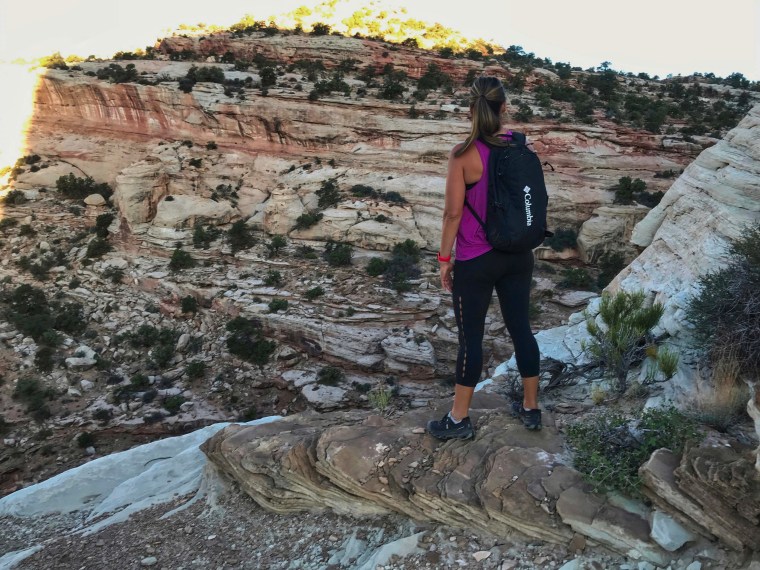
I drove Karen up the mountain to the entrance of Bryce Canyon National Park for a half-marathon, which goes down the mountain ending near our campground, Bryce Canyon RV Resort. The race would start at 6:00. I went back to camp and did some work. I was surprised to see the winning male runner flying down the road about an hour and a half later. Unexpectedly, this is a popular race for several reasons. It is very well organized from the sign-up, the dinner, water and toilets all along the route and police helping everywhere. The kids joined Karen as she came by the campsite. We walked down to the finish line where food and drinks were being served. The second reason it is popular is the scenery is beautiful. Karen said it took her mind off running. Third, it is all down hill – mostly.
Bryce Canyon RV Resort
Two hours later, she had showered and we were hiking The Hoodoos. Bryce Canyon National Park has the largest collection of hoodoos (Pillars of Stone) anywhere in the world. We went to the Visitor’s Center, looked around, and asked if Josh’s AirPods had been found. Karen filled out a form in case they were turned in.
We retraced our stops on the Scenic Drive to see if we could find them. Josh was tracking their location with his phone, and I was surprised how closely it could be tracked. It put us at one overlook, which we scoured. A big raven sat on a pillar and let me come right up to him. I once had a crow, and I know how intelligent these birds are. I talked to him face-to-face, and he looked a little guilty. Tracking put them across the street from the overlook. I looked for a nest, but didn’t see one. We might have walked around in the woods, but it was a steep drop-off.
Since the AirPods weren’t turned on, they could only track the last known position. If someone had taken them, they would have turned them on. My guess is the guilty-looking raven took them. They love collecting things, mostly shiny things. Well, we did what we could.
We hiked up a beautiful stream to Mossy Cave. People were stopping to walk in the cool waters, but it was a comfortable day at approximately 8,000’.
Back at the rim, we hiked down into the hoodoos to find trees and shrubs growing amongst the hoodoos. It was very cool….until we had to hike back up. These hoodoos are like amphitheater’s.
At sunset, we returned, casually walking around the rim to a pretty overlook. People were sitting with their dinners or drinks enjoying the peaceful beauty.
In Capitol Reef National Park, Karen and I got up at 6:00 to hike the Golden Throne hike at the end of the Scenic Drive, then down a gravel road to a parking lot in Capitol Gorge. I had some big concerns, too many to list, but I knew we had to hike up a very large mountain. How vertical would it be?
I was glad to see it wound its way around the cliff, deep into a canyon, across the other side, winding again. It could not have been made any easier, and it was very pretty. I stopped to catch my breath several times, as Karen let me set the pace until I took a wrong turn. Then she took the lead.
Looking back down at the Canyon parking lot
We arrived at a plateau looking up at the Golden Throne, which I suppose is golden in the right light. It took us about 45 minutes to get there, and it would be an easy down hill going back. We walked around to see if we could get a better view of the canyon, the only way through this massive 100-mile wall that is compared to an ocean reef. People have been coming through this canyon for thousands of years. Ancient petroglyphs decorate the walls, as well as Europeans who came through in the late 1800’s.
I tried not to take this personally
It was a beautiful morning with great views and an easy walk down. Driving back to our campsite, I let Karen out to run the last three miles. She is training for a 50-mile race.
It was moving day, so we began the process of packing up. Everyone pitched in, and we were beginning to get into a process that made it a lot easier. Melissa was in charge of closing and locking all the windows while Josh put up the stabilizers. Martha got the inside organized and ready while Karen and I hitched up.
We drove north to Torrey and turned southwest on Utah Rt. 12 where a sign declared it an America’s Highway. Martha looked up what that meant. There are Scenic Highways, but an America’s Highway is a step above. It deserves its designation. The changes in scenery were dramatic. First it was green on this side of the mountain and through a valley. Then we began a long climb up another series of mountains that were green, with pine trees covering everything.
Climbing to 9800’, we pulled over to a beautiful overlook. You could take all day stopping at overlooks on this drive to Bryce Canyon. Down the other side, now winding its way through solid, almost white rocks. Then back up on top of a ridge with incredible views on both sides. An Airstream was perched on top on one overlook where they had probably stopped for lunch. One stretch was along the top of a ridge barely wider than the road. I know the views were spectacular, but I couldn’t take my eyes off the road.
Back down the other side, we stopped at Escalante Mercantile for some lunch. A lady was training a young lady the ropes on her first day on the job. It is a very nice store/restaurant/bakery. It took us a while to figure out how to order, what to order and to get it ordered as locals and travelers stopped for lunch or a snack. It proved to be a great, little stop.
Then it was only 35 minutes to our campground at Bryce Canyon RV Resort. It was a KOA, but it now has new owners. It took a while to park in our tiny spot. A nice man across from us was nice in moving his truck so we could wiggle in. We started to level as we looked at some bigger and nicer spots on the other side.
Martha and I went back in and asked if we could move. The very nice ……, gave us some choices, explaining how they had recently bought the campground. I’m sure I had picked a spot away from the highway, but the sites were bigger and had some shade. It was a good move.
Josh was happy to see a basketball net with a paved playing area, so we went over and played Horse. Of course I won every game……NOT! …….came over to take some promotional pictures of the court being used. At 12 years old, Josh’s basketball skills have improved dramatically.
Tomorrow there is a half marathon and a 5K race. Karen signed up in a park in the cute, little town of Tropic. There was a fund-raising spaghetti dinner this evening, so we decided to come back for that.
Half marathon sign-up
Then we drove up to Bryce Canyon National Park to get the big picture. It was busy and crowded, but it was OK. We went to spectacular sunset point. I would have to stay up for another sunset. Then we drove the 15-mile scenic drive atop a grand mesa. Surely we would see lots of wildlife in the early morning or late evening. More pretty views in the land of Hoodoos. Like Goblin Valley, you could go down and walk among the giant Hoodoo maze.
We drove back to Tropic where the crowds gathered for the marathon spaghetti dinner, which was better than I expected, and very efficiently served. We talked with a man next to us about the race tomorrow and about the hike to Angel’s Landing in Zion National Park. He said it is a typical government-run drawing for tickets. Everyone lines up at 8:00 or 11:00 for tickets, then they all go for the hike together. Too many people for his liking, but they did it. I think Karen will be the only one to do this.
Josh lost his Apple Airbuds somewhere on the Scenic Drive in Bryson Canyon. All that getting in and out of the truck at different stops. Surely they will be gone tomorrow, but we will go look and check Lost-and-Found.
This is the second time I have been to Capitol Reef, and he first time I have stayed in Fruita Campground. It is a wonderful 100-mile outcropping of steep cliffs with a pretty stream running through it, the Fremont River. There is a lot of history here that goes back 10,000 years or more. Sunset Point is a pretty spot any time of the day, but great at sunset.
The Hickman Bridge hike is a 2-mile out-and-back trail to a 133 foot natural bridge with views of the canyon. We had a beautiful day to hike after setting up camp in the Fruita Campground beside the Freemont River. Deer frequent the grassy campground. The hike is a good one, with good scenery.
Goblin Valley State Park is rated #1 in a top ten state parks article. Well-dispersed campsites, cool yurts, great scenery and cute, little shaded picnic tables add up to a great experience. Oh yes, and then there are Goblins!
Just outside Goblin Valley State Park is Wild Horse Canyon, which can be a four-mile or eight-mile hike. We opted for the four-mile, which meant we would hike up the slot canyon until it meets a gravel road, then go back down. A sign warned to check weather before hiking. Flash flooding can put you in danger in a slot canyon. “Be aware of your escape route.” Capitol Reef National Park had big flooding issues three weeks ago. Six people had to be rescued and 60-80 people were stranded in a parking lot.
Although an incredibly beautiful storm came through last night, there was nothing expected today, and it was a beautiful morning. It starts out walking up a dry stream bed. We talked with an experienced family with three small children, who said the forecast was good. They were obviously experienced hikers with all the right gear. The husband had climbing gear and a rope over his shoulder. I felt good following them, but when we stopped to photograph a few lizards, they were gone. I’m pretty sure they were doing the 8-mile loop and would come down the slot canyon on their way back.
As the canyon narrowed from 60 yards to four feet, to 3 feet, we had to negotiate rocks and puddles of water. Once we surrendered to getting our feet wet, it became easier, but still challenging. Karen and Nathan are tremendous athletes and the kids are too. Melissa, usually silent until after noon, was leading the way, talking and laughing the entire way. I couldn’t help but laugh. She is a gymnastic star and cheering team member with strength and flexibility that are incredible. She was playing a Disney star describing the challenges presented.
As with most hikes, Martha and I were glad to get to the top, but already wondering if going down would be even tougher. Fortunately it was easier. I think everyone rated it one of their favorite hikes. It was pretty, challenging and very different. I kept looking for mountain lions or goats, but never saw anything. Karen, however, spotted several pronghorn on the way to the hike.
We were first scheduled to stay two nights in Goblin Valley, but it has been very hot and Goblin has no electric, or hookups. You can get water, and there is a dump station. It’s a cool campground, with views of the Goblins and mountains. It was a little intimidating at first, being so hot, and it is in the middle of nowhere. Once we got used to it, and all it’s beauty, two nights would have been fine.
There are no hikes in Goblin Valley. You just wander Goblin Valley on your own. Karen decided to take a trail that leads to Goblin Valley from the campground, up and over a small mountain, then down through a narrow wash that finally led us to the Goblins, the Three Sisters and up to the parking lot overlooking Goblin Valley Three. Again, it is so hard to imagine this whole, dry area covered by an inland sea, but it was, and what made this area unique is it was a tidal marsh, shallow and rising and falling. This led to some very unusual stone structures.
After drinking some water, we wandered through the valley. It’s very cool, with canyons and corridors leading everywhere. We ended up following a Goblin-surrounded canyon winding through some tall cliffs and interesting “faces” looking down on us. It continued to narrow until we all agreed it didn’t lead anywhere, so we turned around.
Melissa takes a break
Some didn’t seem so happy with us
Thankfully, Martha and Melissa had gone back to get the truck early in the trip, but it was only .8 mile back to camp. They have wonderful covered and wind-protected picnic shelters at every camp site. If you were in the shade, there was a nice breeze, and it was quite pleasant.
Then the winds came. A storm and big, black cloud came over the mountain, blowing sand and raining over the dry valley. We quickly closed the windows in the trailer, but the sand had blown in. As it seemed to subside, I reopened the windows, but it blew again. It was so fierce, the kids hit the floor!
As the storm passed in front of us, there came a very pretty rainbow, the rain and sand extending the rainbow as I have never seen before. We saw the other end of the rainbow was over Goblin Valley, so we jumped in the car and drove up there. We did get some pictures of the rainbow over “The Three Sisters”. It was so cool!
We drove to the other end of the campground to find several yurts in great spots, one tucked up in a little cove up against the mountains, with a porch, a grill and picnic table. What more could you want?
Revisiting Canyonlands was fun. Sitting up on a high mesa, it is 10-15 degrees cooler than Moab. We walked the Rim Trail, and Karen was able to take a 3-mile run. It is a pleasant park divided into three parts by the Colorado and Green Rivers. Some parts are only accessible by gravel o9r sand roads from the south. floating through it on one of these rivers would be a great way to see it.
On our way up to Canyonlands National Park, we first stopped at “The Monitor and Merrimac” rock features. To the east were the La Sal Mountains and Mount Waas at 12,306’. We turned left (east) we came to Dead Horse State Park, not knowing what to expect. Well, my new friend, Cindy, at Riverside Plumbing said she and her future husband used to go up to Dead Horse State Park for a date.
I think it was a $10 entry fee, but we had bought a Utah State Park pass, so they waved us on. The park overlooks a gooseneck turn in the great Colorado River. It really is as pretty a spot as one could wish for. A cute couple were having breakfast at the overlook at sunrise, giddy in their young love in such a gorgeous spot.